
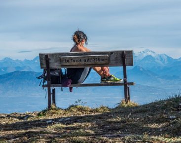


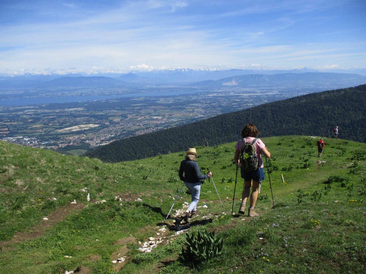
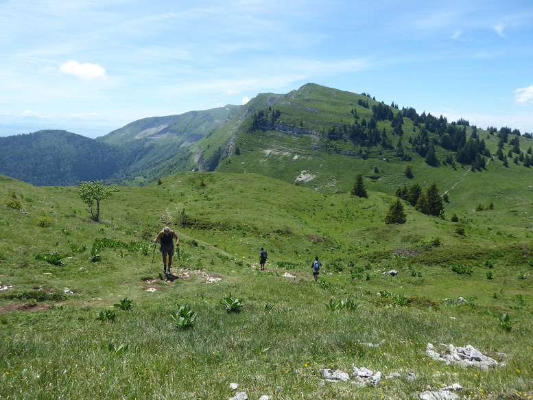
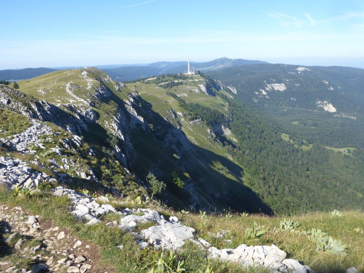
This itinerary in loop towards the crests offers one of the most beautiful panoramas on the chain of the Alps including the Mont-Blanc as well as all the region of Lake Geneva and the Jura.
This is one of the major hikes to discover from La Faucille, accessible to most hikers.
This route is forbidden to dogs because it follows a private property: (the Alpage du Crozat). The presence of dogs outside disturbs the work of the "patous". Thank you for your understanding.
To discover :
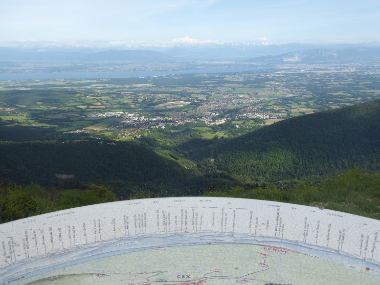
360° panorama on the summits : all the Lemanic basin : Pays de Gex, Lake Geneva. The chain of the Alps (with the Mont-Blanc), side Jura: Les Hautes Combes. At the foot of the Monts-Rond : the Creux de l'Envers forest.
Flora on the trail : in the undergrowth : petasites and Alpine lettuce. In the Alpine meadows: orchis, spring and Koch's gentian, large yellow and vertre gentian, carnations.
The Nature Reserve is very close : More info : National Nature Reserve of the Haute Chaîne du Jura www.rnn-hautechainedujura.fr.
Landmark : From Petit Montrond, in the distance, towards the South, you can see the Colomby de Gex pylon (1689 m alt).
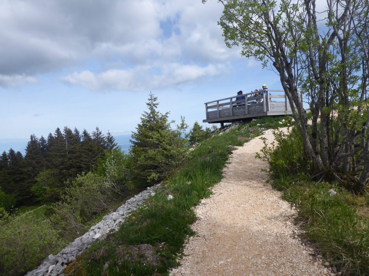
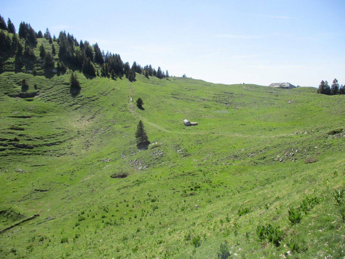
Guidebook with maps/step-by-step: 1st part: Follow the "yellow" markers on the path that winds through the forest to reach Petit Montrond at 1533 m (white and red markers). The surface is mainly crushed stone, with numerous steps. On the upper part of the route, 3 wooden platforms with picnic tables and benches facing the panorama await you. At the summit, the viewpoint is equipped with an orientation table + binoculars.The high-altitude restaurant is open in July and August. (at the same times as the gondola). Check opening days.The 2nd part of the route involves crossing the ridges to the south to reach the Grand Montrond at 1596 m. Marking is the GR9 (red and white) at the foot of the Grand Montrond.Part 3: the descent from Grand Montrond to return on the same GR9 trail. Passage via the Gelinottes ski lift/trail and descent through the forest to the resort center.
More information:
Safety instructions: This trail is locatednext to the Haute Chaîne du Jura National Nature Reserve. Before setting off :- Check the general and local weather forecast, and make sure there's no precipitation.- Find out about the approach route, the height of the itinerary, the time it will take to complete the climb, and any possible escapes (IGN map, GPS, topo-guide, etc.).- Evaluate possible risks by asking mountain professionals, refuges and gîtes.- Inform someone close to you of your objective, and contact them again in the event of any changes: departure and return times, number of participants with telephone numbers for each, vehicle(s), parking, etc.- Avoid setting off alone, and use equipment that is suitable for the activity, adjusted and in good condition: headlamp, complete first-aid kit, survival blanket, etc.In the event of a problem, call 112 (European emergency number).This route borders a mountain pasture where patous sheep are present: The Patou or guard dog: what attitude should you adopt?When out hiking, it's not uncommon to come across flocks of sheep or goats guarded by guard dogs known as patous. These dogs, formidable against predators such as wolves, bears and lynxes, can frighten hikers with their barking.The patou protects flocks in total autonomy. Its main role is to deter intruders and alert the shepherd. Raised among the ewes from an early age, he learns to protect them at all times, often in groups.To avoid problems with a patou:-Identify grazing areas before setting off.-Keep your distance and go around flocks if possible.-In the event of an encounter, stay calm, turn back slowly or stop to let the dog sniff you out.-Don't try to pet or feed the animals, avoid sudden movements, don't run, and avoid taking photos.For runners:-Do not run when approaching a herd.-Take off your headphones to hear the dog's barking.-By adopting these behaviors, you'll be able to cohabit serenely with guard dogs on your hikes.
Itinerary
In detail
- Distance: 6.7 km
- Markup: BALISE
- Elevation gain : 375 m
- Negative elevation gain : 375 m
- Daily duration: 180 min
- Type of route: BOUCLE
- Beaconing accuracy: Follow the GR9 (red and white) to the Grand Mont Rond, then follow the yellow markings to the Petit Mont Rond.
- Nature of the land: Ground
- Nature of the land: Not suitable for strollers
Opening
From 01/04 to 30/11.
Rates
Free access. Pedestrian pass for the gondola, payable at the lift ticket off.
Facilities & services
Facilities
- Public WC
- Car park
- Orientation board
- Free car park
Host language(s)
- French
