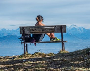
Enjoy a hike on the crests where you will admire panoramic views of Mont-Blanc, the Alps and the Lake Geneva basin, Geneva so close, the Hautes-Combes du Jura... Before coming back down to the heart of the resort.
Remember that you are up in the mountains and the weather conditions can change very quickly. Do not venture into unknown areas if your mountain experience does not allow you to do so. If you wish to continue your hike on the ridges in the direction of Colomby de Gex (unmarked), you will enter the territory of the National Nature Reserve of the Haute Chaîne du Jura. You will then have to respect the regulations.
Guidebook with maps/step-by-step: Leaving the Télécombi finish terrace, go right and then down onto an esplanade under the TDF relay. Descend into a hollow, then climb back up to the left, following the markers. The panorama of the Alps is immediately apparent. The route climbs steadily to a plateau where snow is often scarce because it's blown away. From here, descend to a signpost. Follow the signs for Grand Montrond on your left (if you take the option to go towards Chalet du Crozat, you can avoid the summit and return directly to the resort). A steady climb takes you to the summit of Grand Montrond (don't go near the ledges, which may give way under your feet!).The descent towards La Faucille takes you back to the Chalet du Crozat and then to a ski slope which you have to cross to reach the forest. Cross over a footbridge and descend to a wider track that leads back to the heart of the resort.
More information:
Pre-outing preparation1. 1 Weather○ Find out about general and local weather conditions.○ Find out about snow quality and changes in conditions depending on sunshine (icy, powdery, etc.).○ Check that no precipitation is forecast.1. 2. itinerary○ Find out about the approach and height of the route.○ Consult route time and reclimbing possibilities.○ Use resources such as IGN maps, GPS, topo-guides.1. 3 Risk assessment○ Ask mountain professionals (guides, refuges, lodges) about possible risks.Communication1.1 Inform a loved one○ Communicate your goal to someone close to you.○ Provide planned departure and return times.○ Give the number of participants with everyone's phone numbers.○ Specify vehicle(s) and parking location.Equipment and safety1. 1. equip yourself correctly○ Do not set off alone.○ Use equipment that is suitable for the activity, well adjusted and in good condition.○ Carry a headlamp, a complete first-aid kit, a survival blanket, etc.○ Wear clothing suited to the season and conditions (cold, hot, wet...).○ Hiking shoes suited to the terrain (even for children!).○ Use hiking poles (useful for stability and to take the strain off joints).○ Carry a cell phone and spare battery.○ Take a water bottle or gourd, and something to eat.In the event of a problem1. 1. emergency number○ Call 112 (European emergency number).By following these steps, you ensure that you maximize your safety and that of your companions during your mountain outing. Happy hiking!Enjoy your winter adventure in complete safety!
Itinerary
In detail
- Distance: 5.4 km
- Markup: BALISE
- Elevation gain : 370 m
- Negative elevation gain : 315 m
- Daily duration: 120 min
- Type of route: ALLER_RETOUR
- Beaconing accuracy: Follow the purple milestones.
- Nature of the land: Non-groomed itinerary
Opening
From 01/12 to 31/03.
Rates
Free access.
Facilities & services
Facilities
- Bar
- Public WC
- Car park
- Orientation board
- Free car park
Services
- Pets welcome
Host language(s)
- French


