The GR® 9 begins in St-Amour 39. In the department of Ain, it goes all over the oriental crest, by Colomby de Gex, goes through the gap Nantua-Bellegarde, visits plateau de Retord and goes through Grand-Colombier, before diving in the Rhône valley.
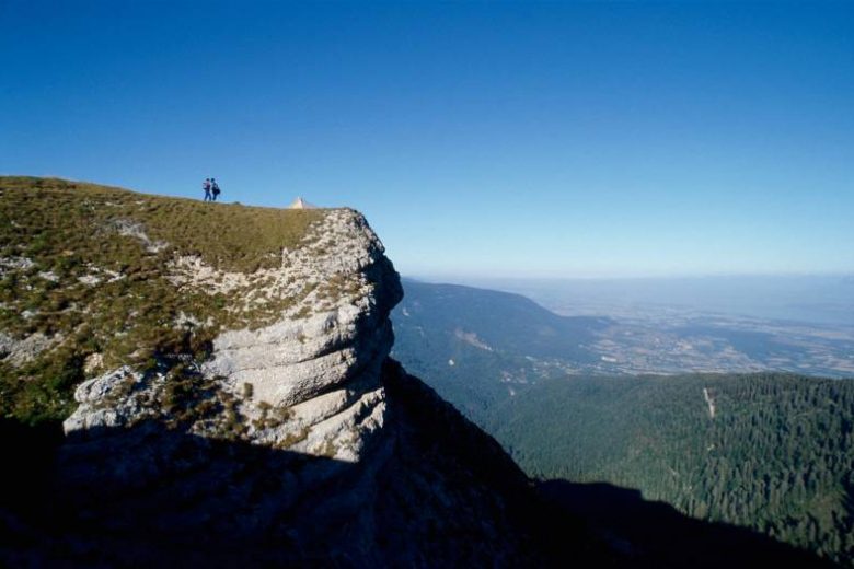
The GR® 9 arrives in the Ain département at Mijoux and follows the Monts-Jura ridge, passing Crêt de la Neige, the highest point in the Jura massif. It descends to Bellegarde before visiting the Retord plateau and crossing the Grand-Colombier. It then reaches Culoz and the Rhône valley, before leaving the Ain for Savoie and continuing southwards.
Guidebook with maps/step-by-step: Step-by-step instructions: From Mijoux to Culoz via the GR9 : Day 1: Mijoux -> Refuge de la Loge, approx. 6h.You follow the trail through the National Reserve.Distance: 13.8 kmDifference in altitude:D+899 m/ D-451 m.Itinerary: Follow the GR (red and white) through the village towards La Faucille, then Grand Mont Rond, Colomby de Gex, Col de Crozet, Refuge de la Loge.Day 2: Refuge de la Loge -> Refuge du Gralet. Approx. 4 hrs.You follow the trail through the National Reserve.Distance: 11.2 kmDifference in altitude: 435 D+ / 435 D-Itinerary: from the refuge de la Loge, follow the signs for “sous le crêt” for a good hour and a half to reach the highest point in the Jura massif: Crêt de la Neige 1720m. This beautiful aerial trail then leads to the summit of Le Reculet (1719m) and briefly over various crests. For the more adventurous (weather permitting), there is an alternative route. A path leads to the Grotte Marie du Jura. The path then goes deeper into the undergrowth, before arriving at the Refuge du Gralet.Day 3: Refuge du Gralet -> Lancrans. Approx. 6 hrs.Follow the trail through the National Reserve.Distance: 17.8 km Difference in altitude: 462D+/1419 D-Itinerary: From Le Gralet on the GR (red and white) head for La Poutouille, La Pelaz, La Corne, Chalet du Sac, Pierre à Fromage, Crêt de la Goutte, Sorga d'en Haut, Métral, and Lancran. Day 4: Lancrans -> Les Bergonnes Distance: 22.15 km Difference in altitude: 1099 D+ / 379 D-Itinerary: From Lancrans, follow the GR downhill towards les pertes de la Valserine, Bellegarde-sur-Valserine, Gare de Bellegarde, Rue Lafayette, Mussel, Ochiaz, Catray, Pra devant, la Charnay, le Tumet, Crêt du Nu and Croix des Terments. (A short detour to Les Bergonnes for the night). Day 5: Les Bergonnes -> Chalet D'Arvière. Approx. 4h30Distance: 15.3 kmDifference in altitude: 349 D+/ 334D-Itinerary: From Les Bergonnes, follow the GR to Croix des Terments, Planvanel, Crêt Dauphin, Col de Richemond, Grange d'en Haut, Grange d'en Bas and Chalet d'Arvières. Day 6: Chalet D'Arvière -> Culoz; Approx. 6 hrs.Distance: 19.8 km Difference in altitude: 386 D+ /1333 D-Itinerary: From Chalet D'Arvières, still on the GR, follow Sapin Daubré, Col de Charbemène, Croix du Colombier, Col du Colombier, Grange à Masse, Granges neuves, then Culoz.
More information:
Safety instructions :This trail crosses part of the Haute Chaîne du Jura National Nature Reserve, so please respect its regulations. https://www.rnn-hautechainedujura.fr/Among these rules: Dogs forbidden, even on a leash!Before setting off : - Check the general and local weather forecast, and make sure there's no precipitation.- Find out about the approach to the route, its height, how long it will take to reach the summit and any possible escapes (IGN map, GPS, topo-guide, etc.).- Evaluate possible risks by asking mountain professionals, refuges and gîtes.- Inform someone close to you of your objective, and contact them again if there are any changes: departure and return times, number of participants with telephone numbers for each, vehicle(s), parking.- Avoid setting off alone, and use equipment that is suitable for the activity, adjusted and in good condition: headlamp, complete first-aid kit, survival blanket, etc. In the event of a problem, call 112 (European emergency number).This route borders a mountain pasture where Patous dogs are present:The Patou or guard dog: what attitude should you adopt?When hiking, it's not uncommon to come across flocks of sheep or goats guarded by guard dogs known as patous.These dogs, formidable against predators such as wolves, bears and lynxes, can frighten hikers with their barking.The patou protects the herds in total autonomy. Its main role is to deter intruders and alert the shepherd. Raised among the ewes from an early age, he learns to protect them at all times, often in groups.To avoid problems with a Patou: - Identify grazing areas before setting off.- Keep your distance and go around flocks if possible.- In the event of an encounter, stay calm, turn back slowly or stop to let the dog sniff you out.- Don't try to pet or feed the animals, avoid sudden movements, , and avoid taking photos.- Do not run when approaching a herd.- Take off your headphones to hear the dog's barking.By adopting these behaviors, you'll be able to cohabit serenely with guard dogs during your hikes.
Itinerary
In detail
- Distance: 100 km
- Markup: BALISE
- Elevation gain : 4330 m
- Negative elevation gain : 3580 m
- Duration of itinerary: 6 day(s)
- Type of route: ALLER_ITINERANCE
- Beaconing accuracy: White/red markings
- Nature of the land: Ground
Opening
Free access (weather depending)
Rates
Free of charge
Facilities & services
Facilities
- Car park
Services
- Coach access
- Accommodation


