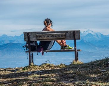
Snow shoes on your feet, set off to discover the famous Crêt de la Neige, culminating point of the Jura offering a spectacular scenery!
In many places, you'll be able to admire panoramic views of Mont-Blanc, the Alps and the Lake Geneva basin, nearby Geneva, the Salève, the Ecluse gorge, the Hautes-Combes of the Jura.
Don't forget that you're in the mountains, and that weather conditions can change very quickly. Don't venture into unfamiliar areas if your mountaineering experience doesn't allow you to.
Part of this route lies within the Haute Chaine du Jura National Nature Reserve. Please respect the regulations in force and stay on the marked trail.
From December 15 to June 30, there are also quiet zones for wildlife. Access to these areas is strictly forbidden. For further information, please visit the Nature Reserve website.
Guidebook with maps/step-by-step: From the top station of the Fierney gondola, take the purple-marked path that winds under the Bergers telecabin. (take care when crossing slopes).When you reach the summit of Monthoiseau, follow the Monthoisey to the edge of the Anémones piste verte. From here, pick up the hiking trail (yellow PR), and enter the Nature Reserve. Head for Grand Crêt (1702m). Follow the ridge, passing “sous le Crêt”, where the GR (red and white) arrives from Lélex, and continue straight on to the highest point: Crêt de la Neige. Return along the same route. Take the long climb through the woods, following the signs on the trees and the milestones. All crossings are equipped with directional signs.Arriving below the Ratou chalet, take the access to Crêt de la Neige via Brulats-Frésy. This passage then borders a wildlife tranquility zone which is off-limits from 15/12 to 30/06. The route gradually leads to Les Brulats-Frésy. The flat section leading to Brillones d'en Haut offers a respite before tackling an ascent through the combe des Voyettes. The trees become increasingly scarce, and the route then crosses an open area until it reaches the ridgeline. A canyon is then reached, which we cross before reaching the final section leading to the summit of Crêt de la Neige, marked by a post.In the distance, you can see the Reculet cross, the second-highest summit in the Jura mountains. The route is signposted all the way to the "Sur les Brulats" crossroads for those who wish to venture further...The return journey takes the same route.
More information:
Pre-outing preparation1. 1 Weather○ Find out about general and local weather conditions.○ Find out about snow quality and changes in conditions depending on sunshine (icy, powdery, etc.).○ Check that no precipitation is forecast.1. 2. itinerary○ Find out about the approach and height of the route.○ Consult route time and reclimbing possibilities.○ Use resources such as IGN maps, GPS, topo-guides.1. 3 Risk assessment○ Ask mountain professionals (guides, refuges, lodges) about possible risks.Communication1.1 Inform a loved one○ Communicate your goal to someone close to you.○ Provide planned departure and return times.○ Give the number of participants with everyone's phone numbers.○ Specify vehicle(s) and parking location.Equipment and safety1. 1. equip yourself correctly○ Do not set off alone.○ Use equipment that is suitable for the activity, well adjusted and in good condition.○ Carry a headlamp, a complete first-aid kit, a survival blanket, etc.○ Wear clothing suited to the season and conditions (cold, hot, wet...).○ Hiking shoes suited to the terrain (even for children!).○ Use hiking poles (useful for stability and to take the strain off joints).○ Carry a cell phone and spare battery.○ Take a water bottle or gourd, and something to eat.In the event of a problem1. 1. emergency number○ Call 112 (European emergency number).By following these steps, you ensure that you maximize your safety and that of your companions during your mountain outing. Happy hiking!Enjoy your winter adventure in complete safety!
Itinerary
In detail
- Distance: 10.7 km
- Markup: BALISE
- Elevation gain : 495 m
- Negative elevation gain : 495 m
- Daily duration: 300 min
- Type of route: ALLER_RETOUR
- Beaconing accuracy: Marked in purple + hiking markers
- Nature of the land: Non-groomed itinerary
Opening
From 01/12 to 31/03.
Subject to favorable snow and weather conditions.
Rates
Free access.
Facilities & services
Facilities
- Car park
Host language(s)
- French


