


A tourist road to the summits of the Jura Mountains!
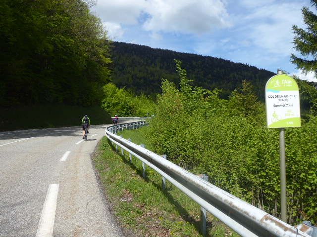
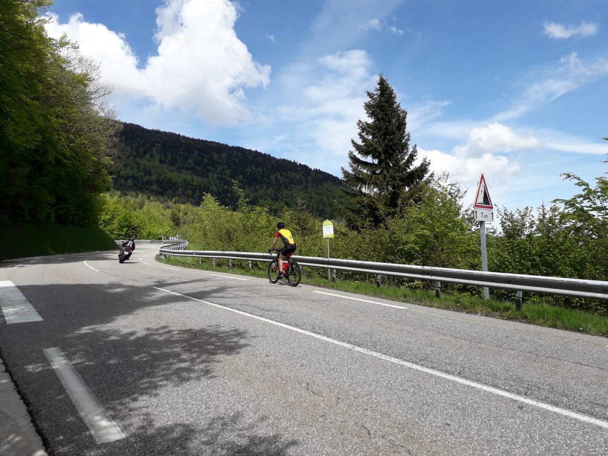
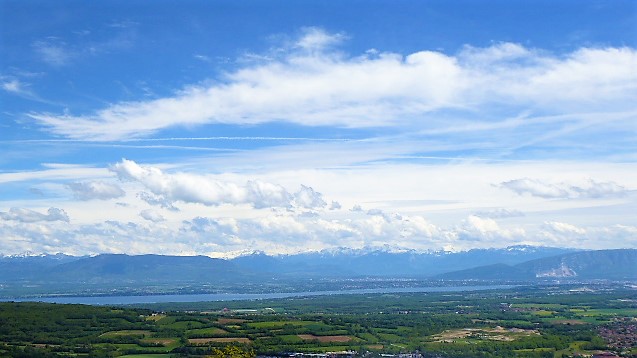
The Col de la Faucille (1323 m.) from Gex, offers an ascent with a magnificent view on the Mont-Blanc, the Genevois and the Lake Geneva. It owes its name to its sickle-shaped silhouette when seen from the Geneva side. At the top, one approaches the highest peaks of the Jura massif located in the Ain (Crêt de la Neige 1 720 m.).
The pass is located at the limit between the communes of Gex and Mijoux (8,5 km).
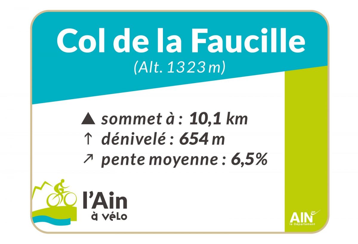
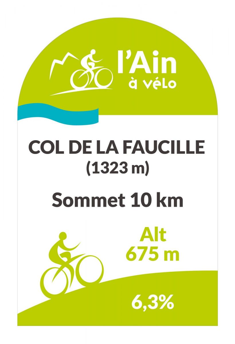
The climb from Gex (10.1 km - 6.5% average gradient for 654 m of ascent) has been used 20 times by the Tour de France since 1947 and is classified as 2nd category in the Grand Prix de la Montagne du Tour de France. The highest percentages are concentrated on the last 5 km (up to 8.1%).
For the record, it was the Frenchmen Guy Ignolin in 1963 and Mariano Martinez in 1975 who distinguished themselves by taking the lead. In the last edition in 2004, it was the Spaniard Juan Miguel Mercado who took the lead.
Translated with www.DeepL.com/Translator (free version)
More information:
Safety tips and instructions for experienced cyclists, to keep pedaling a pleasure. Helmet mandatory (with your head well protected, it's a safe adventure!)Bike gloves (for a good grip and hands in superhero mode)Sunglasses (style and protection, a winning combo)Maximum visibility :Reflective safety vest mandatory outside built-up areas, at night or in bad weather (shine brightly to be seen!)No music while riding:Headphones, earpieces and phones in your ear are forbidden (stay focused, the road is serious business).Respect the Highway Code:Safety and courtesy for you and other road users (a little gesture, a lot of respect)Cyclists and motorists: the road is more beautiful when we respect each otherRemember to stay hydrated Pay attention to the weather:In the mountains, conditions can change rapidly (wear the right gear and stay safe).Ride safely and enjoy your cycling adventure!
Itinerary
In detail
- Distance: 10.1 km
- Markup: BALISE
- Elevation gain : 652 m
- Negative elevation gain : 1 m
- Daily duration: 75 min
- Type of route: ALLER_ITINERANCE
Opening
All year round.
Be careful, the road is regularly covered with snow in winter.
Subject to favorable weather.
Rates
Free access.
